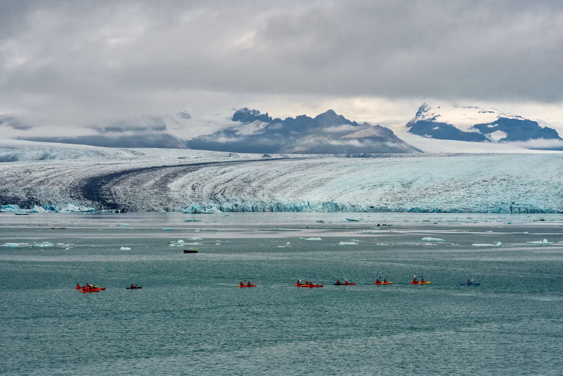
Vatnajökull is Iceland's largest ice cap, covering roughly 8% of the country with an average ice thickness of 380 meters. It hides some of the island's most active volcanoes beneath its surface, creating a volatile landscape of fire and ice.
Vatnajökull dominates southeast Iceland, spanning 7,700 square kilometers and holding roughly 3,000 cubic kilometers of frozen water. It sits at the center of Vatnajökull National Park, a 14,967-square-kilometer protected area that absorbs 14% of the country. The park includes the former Skaftafell and Jökulsárgljúfur reserves, stretching from the Lakagígar volcanic craters in the highlands down to the Jökulsárlón glacier lagoon on the coast.
Beneath the ice lies an undulating volcanic plateau resting 600 to 800 meters above sea level. This rock floor is fractured by active subglacial volcanoes, including Grímsvötn and Bárðarbunga. Heat from these systems constantly melts the ice above, pooling water in subglacial lakes until the pressure fractures the ice dams. The resulting glacial outburst floods (jökulhlaup) periodically wash across the southern sandur plains. These floods carry millions of tons of black volcanic sediment toward the ocean, constantly rebuilding the coastline. At Skaftafell, birch forests and green vegetation grow right up to the edge of the white ice, sheltered by the surrounding peaks. Arctic foxes hunt in the scrub, and reindeer roam the eastern highlands near Snæfell. The contrast between the lush lowlands and the sterile ice cap is immediate.
Visitors rarely see the central ice dome. You interact with the outlet glaciers—Breiðamerkurjökull, Skaftafellsjökull, and Falljökull—that spill down the mountain valleys. These ice tongues feed the coastal lagoons and carve the landscape. You can walk the black sand at Diamond Beach to see stranded icebergs, hike the 1.5-kilometer trail to Svartifoss waterfall, or take a guided super-jeep into the winter ice caves. The northern section of the park encompasses Jökulsárgljúfur, a massive glacial river canyon carved by catastrophic floods. Here, the Dettifoss waterfall drops 45 meters into the gorge, moving more water than any other fall in Europe. The western edge holds the Lakagígar craters and the Langisjór lake, accessible only when the snow clears in late June. The southern fringe is the most accessible. Route 1 skirts the edge of the ice cap, bringing drivers directly to the Skaftafell visitor center and the glacier lagoons. The park operates 24 hours a day, and entry is free, though you'll pay a regional parking fee at Skaftafell and Jökulsárlón via the Parka app.
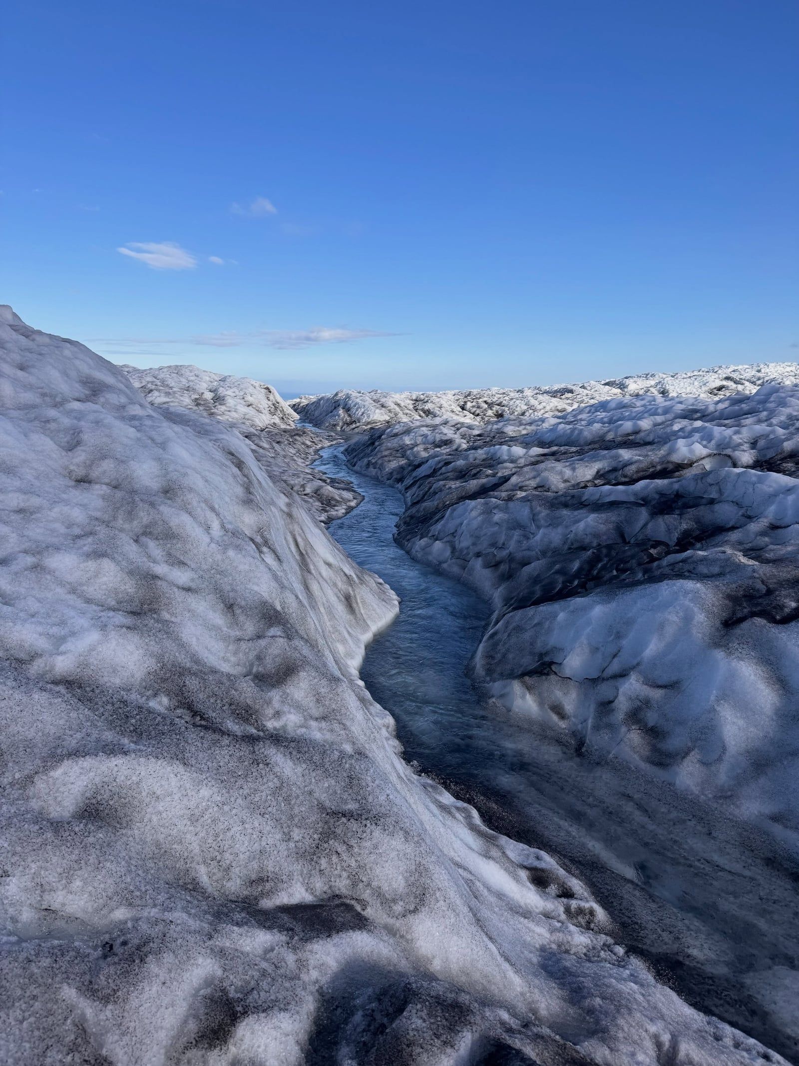
Vatnajökull began to coalesce roughly 1,000 to 1,500 years ago as regional temperatures dropped. Mountain glaciers in the southeast highlands expanded and merged. By the time Norse settlers arrived in Iceland around 874 AD, the ice had formed a continuous cap. It continued to grow over the centuries. The glacier reached its maximum historical extent during the Little Ice Age, peaking between 1450 and 1900. During this period, advancing ice swallowed nearby farms and altered river courses. Early exploration of the ice cap was driven by necessity rather than recreation. Farmers ventured onto the lower glaciers to retrieve stray sheep, but the central dome remained largely untouched. The first recorded crossing of Vatnajökull occurred in 1875 by an Englishman, William Lord Watts, who used the expedition to investigate the erupting Askja volcano. Systematic scientific study began in the 1930s with the Swedish-Icelandic Vatnajökull Expedition, which mapped the subglacial topography for the first time. The ice hit a secondary peak around 1930.
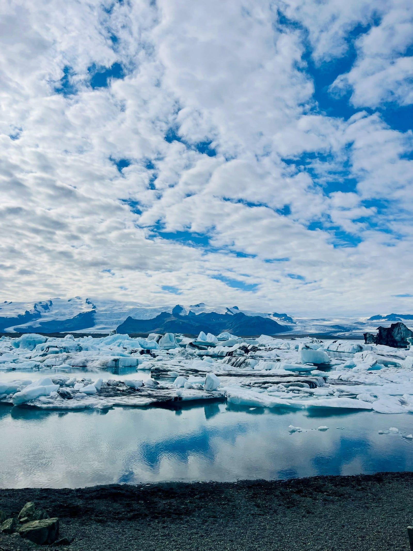
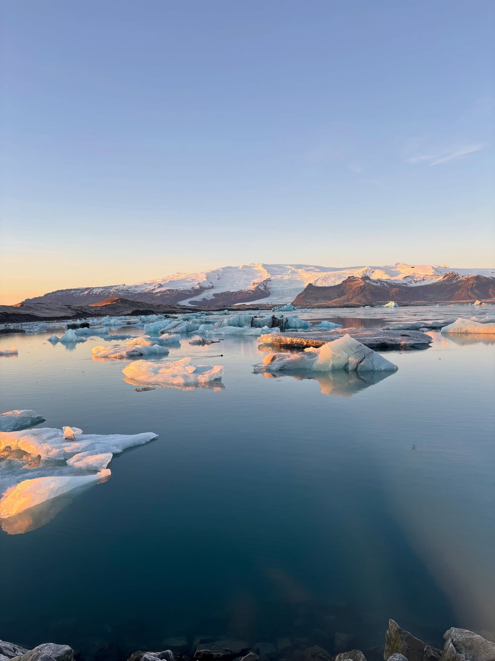
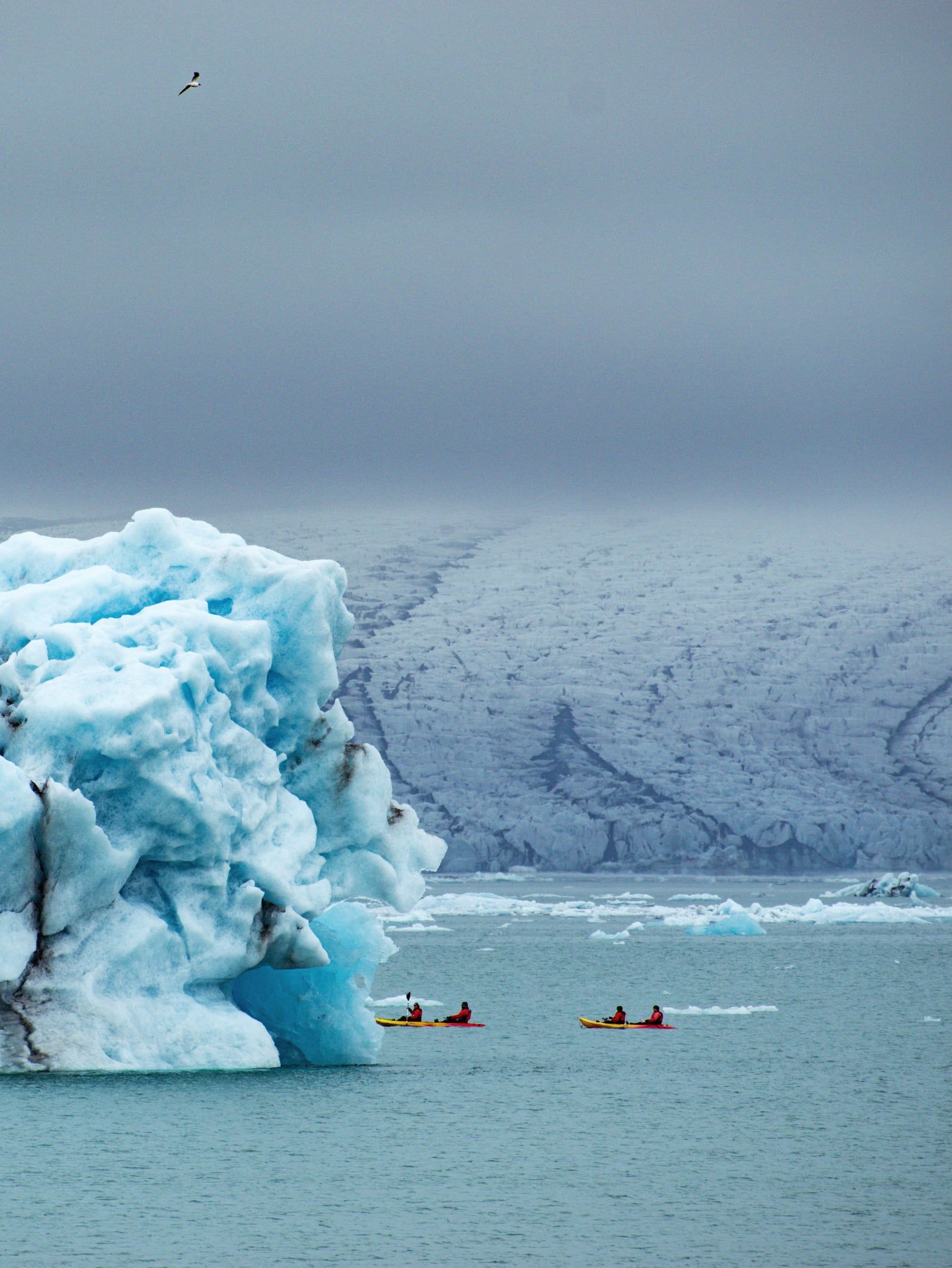
The glacier has been in a long, documented retreat ever since. Rising global temperatures cause the outlet glaciers to thin and recede up their valleys. Breiðamerkurjökull's retreat over the 20th century carved out the Jökulsárlón lagoon. The lake first appeared in the 1930s as a small meltwater pool. It has quadrupled in size since the 1970s, now measuring over 18 square kilometers and reaching depths of 284 meters.
The Icelandic government established Vatnajökull National Park on June 7, 2008. The initial boundary covered about 12,000 square kilometers. It merged the existing Skaftafell and Jökulsárgljúfur national parks with the central ice cap. The park expanded over the next decade. Authorities added the Lakagígar craters, Langisjór lake, Krepputunga, and finally the Jökulsárlón lagoon area. This brought the total protected zone to 14,967 square kilometers, making it the second-largest national park in Europe after Russia's Yugyd Va.
UNESCO inscribed the park as a World Heritage Site on July 5, 2019. The committee cited the region's specific physical properties—the direct, ongoing collision of active magma systems with a massive ice sheet. This interplay creates unique geological formations, from subglacial lakes to palagonite ridges formed by under-ice eruptions. Today, the park operates year-round, though access shifts heavily with the seasons. Summer allows full highland transit via unpaved F-roads. Winter restricts vehicles to the southern lowland fringes and limits glacier access to guided ice cave excursions.
Vatnajökull averages 380 meters in thickness, with the deepest sections plunging to 950 meters. The ice cap covers roughly 8% of Iceland. Its sheer weight depresses the earth's crust beneath it. The highest point in the country, Hvannadalshnjúkur, rises 2,109.6 meters on the southern rim of the Öræfajökull volcano. Experienced mountaineers climb this peak in the spring, facing a 15-hour round trip across heavily crevassed terrain.
The glacier moves constantly. It flows outward from the central dome through dozens of outlet glaciers. Breiðamerkurjökull pushes directly into the Jökulsárlón lagoon, calving massive blue-white icebergs into the water. These blocks drift through a short channel into the Atlantic Ocean. The tide then throws fragments back onto the black volcanic sand of Diamond Beach. Further west, Skaftafellsjökull and Falljökull drop steeply toward the coastal plain. Their surfaces are fractured by deep crevasses, jagged seracs, and vertical shafts called moulins that drain surface meltwater into the glacier's base. During winter, this meltwater network freezes and drains, leaving behind natural ice caves. Guides lead groups into these caverns from November through March. The cave walls display compressed, electric-blue ice banded with black ash from past volcanic eruptions. The structures collapse and reform every year, meaning no two winter seasons offer the exact same caves.
Volcanic activity defines the bedrock beneath the ice. Grímsvötn is Iceland's most frequently erupting volcano, sitting entirely subglacial. When it or neighboring Bárðarbunga erupts, the magma melts billions of gallons of ice. This water surges beneath the glacier and bursts from the ice edge in catastrophic floods. The park's geology extends beyond the ice. At Skaftafell, the Svartifoss waterfall drops 20 meters over a cliff of dark, hexagonal basalt columns. These geometric rock formations were created by lava cooling slowly inside a volcanic fissure. The columns inspired the stepped concrete facade of Hallgrímskirkja, Reykjavík's largest church. South of the glacier, the Skeiðarársandur outwash plain stretches for miles. This vast expanse of black sand and braided rivers was built by thousands of years of glacial floods. It is the largest sandur in the world, covering 1,300 square kilometers and constantly shifting with every new meltwater surge. In the north, the Askja caldera holds a geothermally warmed crater lake surrounded by the stark black desert of the Ódáðahraun lava field—accessible only by 4x4 vehicles in the peak of summer.
Vatnajökull dictates the geography and survival of southeastern Iceland. For centuries, the ice cap acted as an impassable barrier. Early Icelanders traveling between the east and the south had to navigate the narrow, dangerous coastline or cross the volatile sandur plains. Glacial outburst floods frequently wiped out trails, farms, and bridges. The Ring Road was not completed until 1974, when engineers finally bridged the Skeiðará river across the glacier's southern outwash plain. Before that bridge, driving around the island required a massive detour or a ferry.
The 1783 Laki eruption, located within the modern park boundaries, altered global history. The eight-month eruption released massive clouds of sulfur dioxide. The resulting toxic haze killed over half of Iceland's livestock and caused a famine that wiped out a quarter of the human population. The ash cloud spread across Europe, disrupting summer temperatures and ruining crops. Historians link the resulting European agricultural failures directly to the social unrest that preceded the French Revolution. The glacier also holds a prominent place in Icelandic folklore. Tales of outlaws hiding in the highland valleys around the ice cap date back to the Saga Age. These fugitives supposedly survived by hunting reindeer and bathing in geothermal pools, completely cut off from coastal society. In modern times, Vatnajökull's otherworldly terrain has turned it into a massive outdoor film set. Location scouts use the glacier to represent alien planets and frozen wastelands. Scenes from Game of Thrones, Interstellar, and Batman Begins were all shot on the outlet glaciers or the black sand beaches, cementing the park's visual identity in global pop culture.
Today, the ice cap functions as a highly visible gauge for climate change. Glaciologists and local guides measure the retreat of the outlet glaciers year by year. Skaftafellsjökull has lost hundreds of meters of ice in the last two decades, leaving behind barren moraines. Jökulsárlón lagoon exists entirely because of this rapid melting. The visual evidence of the retreating ice draws researchers from around the world, making Vatnajökull a primary field site for studying glacial dynamics and subglacial volcanism. Local tourism relies heavily on the glacier's accessibility. The town of Höfn and the settlement of Vík anchor the regional economy, providing bases for the hundreds of thousands of visitors who arrive to hike the ice or sail the lagoons. Guides pass down generational knowledge of the ice, reading the weather and the crevasses to safely navigate a landscape that actively tries to kill the unprepared. Book your glacier hikes well in advance during the winter peak.
Grímsvötn is Iceland's most frequently erupting volcano, and it sits entirely beneath the Vatnajökull ice cap.
Hvannadalshnjúkur rises 2,109.6 meters on the southern rim of the glacier, making it the highest point in Iceland.
Jökulsárlón lagoon did not exist before the 1930s; it formed entirely due to the rapid retreat of the Breiðamerkurjökull glacier.
The hexagonal basalt columns behind Svartifoss waterfall directly inspired the design of Hallgrímskirkja, Reykjavík's famous church.
The Laki craters form a 25-kilometer chain of over 130 vents that caused a catastrophic global climate event in 1783.
The ice cap holds roughly 3,000 cubic kilometers of frozen water, making it the most voluminous glacier in Europe.
Vatnajökull National Park covers 14,967 square kilometers, swallowing 14% of Iceland's total landmass.
No, entry to Vatnajökull National Park is free, including access to hiking trails and visitor centers. You only pay regional parking fees at the Skaftafell and Jökulsárlón lots, which start at 1,110 ISK for a standard car.
No. Walking on the glacier or entering ice caves without a certified guide is highly dangerous due to hidden crevasses and unstable ice. All reputable operators require crampons, helmets, and a trained guide.
Natural blue ice caves are generally accessible from November through March. They form each winter when the previous summer's meltwater channels refreeze. December through February is the most structurally stable period.
Jökulsárlón Glacier Lagoon is approximately 380 kilometers from Reykjavík. The drive takes about five hours one-way along Route 1 (the Ring Road).
Hvannadalshnjúkur is the highest peak on the glacier and in all of Iceland. It reaches 2,109.6 meters and sits on the southern rim of the Öræfajökull volcano near Skaftafell.
Yes. Vatnajökull covers several active volcanic systems, including Grímsvötn and Bárðarbunga. Eruptions from these subglacial volcanoes melt the ice above and trigger massive glacial outburst floods.
The main visitor centers, including Skaftafellsstofa, are fully wheelchair accessible. However, most hiking trails and glacier access points involve uneven, unpaved terrain that limits wheelchair access.
Vatnajökull covers about 7,700 square kilometers. It is the largest ice cap in Iceland and the second largest in Europe by both area and volume, trailing only the Severny Island ice cap in Russia.
Recreational drone flying is allowed but heavily restricted in specific zones. Drones are banned in most of Skaftafell and face seasonal bans at Jökulsárlón from April 15 to July 15 to protect nesting birds.
Wear warm, waterproof, layered clothing and sturdy waterproof boots year-round. Weather changes rapidly, and if you book a glacier hike, you will need boots stiff enough to support the provided crampons.
Browse verified tours with free cancellation and instant confirmation.
Find Tours